Aerium Analytics
Locating Man-Made Objects in Vegetation from Aerial Multispectral Imagery

Preparatory material
Calculus, image processing, numerical methods, knowledge of machine learning and computer vision methods. Knowledge of Python is important. Knowledge of Fourier analysis would be beneficial.
Introduction
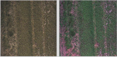
Vegetation mapping often utilizes the benefits of multispectral data as it enables us to highlight specific aspects of imagery which are lacking in RGB imagery. Since we see most vegetation as green, vegetation appears more prominently in the green multiband. Combining specific bands can further emphasize aspects of an image. For instance, the Green-Red-Infrared multiband combination highlights vegetation.
Much research regarding vegetation mapping and classification occurs through the help of multispectral imagery with machine learning and computer vision methods providing many of these answers. With the abundance of such research, we propose taking the advantages of multispectral data in vegetation mapping and classification and utilizing it to find non- vegetation objects located in vegetation. Specifically, can this research help improve the detection of objects which are difficult to highlight with multispectral data such as man-made objects?
The ability to detect man-made objects in vegetation would aid many fields of industry including – but not limited to – search and rescue as well as agriculture. The ability to locate man-made objects such as damaged modes of transportation, camping or hiking equipment, parachutes, etc. in said vegetation aids the chances of locating missing individuals involved in these cases. While much imagery of these objects exists, imagery of them in varying degrees of repair within vegetation is limited at best making standard machine learning detection methods difficult. In such cases, focusing on the vegetation may enable the detection of such objects through machine learning methods where imagery is limited. In agriculture, farming equipment may require repair while in the field where it is easily possible to misplace equipment in vegetation. This lost equipment could damage other farming equipment while work is being done. Locating lost equipment will help limit further damage of farming equipment saving not only money, but time and production as well.
Problem Description
For this project, the team will be given access to aerial multispectral imagery containing a variety of man-made objects located in vegetation. The goal of this project is to develop a method which can detect these random man-made objects using machine learning and computer vision techniques while investigating the benefits of multispectral data to solving this problem. The machine learning field of focus for this problem is that of anomaly detection.

References
- Van Deventer, Heidi & Cho, Moses & Lück-Vogel, Melanie & Van Niekerk, Lara. (2016). Using multi-spectral sensors for vegetation mapping. PositionIT Magazine. July. 26-29.
- Yichun Xie, Zongyao Sha, Mei Yu, Remote sensing imagery in vegetation mapping: a review, Journal of Plant Ecology, Volume 1, Issue 1, March 2008, Pages 9–23, https://doi.org/10.1093/jpe/rtm005
- Oumer S. Ahmed, Adam Shemrock, Dominique Chabot, Chris Dillon, Griffin Williams, Rachel Wasson & Steven E. Franklin(2017)Hierarchical land cover and vegetation classification using multispectral data acquired from an unmanned aerial vehicle, International Journal of Remote Sensing, 38:8-10, 2037- 2052, DOI: 10.1080/01431161.2017.1294781
- Samantha Yeo, Virginie Lafon, Didier Alard, Cécile Curti, Aurélie Dehouck, Marie-Lise Benot, Classification and mapping of saltmarsh vegetation combining multispectral images with field data, Estuarine, Coastal and Shelf Science, Volume 236, 2020, 106643, ISSN 0272-7714, https://doi.org/10.1016/j.ecss.2020.106643.